Loading...
Related Footage

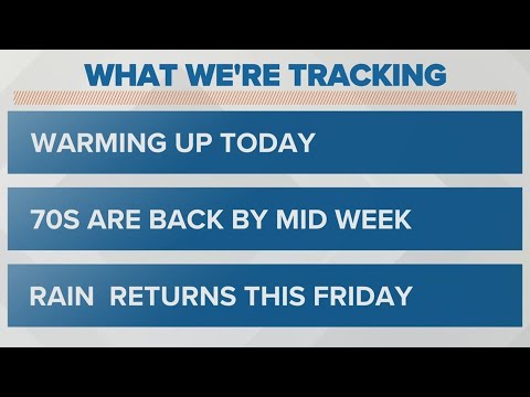
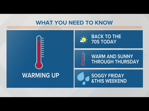
Columbus, Ohio weather forecast | April 11, 2023
Columbus, Ohio weather forecast | April 11, 2023
00:04:05 - Youtube video: qJuagKdz8Iw
Columbus, Ohio weather forecast | April 18, 2023
Columbus, Ohio weather forecast | April 18, 2023
00:02:37 - Youtube video: lTR_bntOCt0
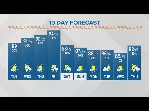
Tuesday afternoon forecast for Columbus, Ohio | July 25, 2023
Tuesday afternoon forecast for Columbus, Ohio | July 25, 2023
00:03:36 - Youtube video: CEt2VkGJL68

Columbus, Ohio weather forecast | Aug. 8, 2023
Columbus, Ohio weather forecast | Aug. 8, 2023
00:03:27 - Youtube video: azCrstqFACA
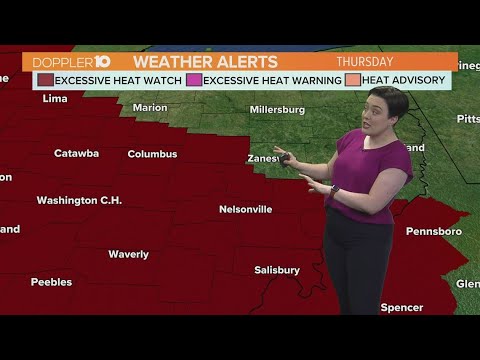
Columbus, Ohio weather forecast | Aug. 1, 2023
Columbus, Ohio weather forecast | Aug. 1, 2023
00:03:26 - Youtube video: bQwwn-xYb5M

Columbus, Ohio weather forecast | Aug. 29, 2023
Columbus, Ohio weather forecast | Aug. 29, 2023
00:03:31 - Youtube video: flxvtUjs4rs
Columbus, Ohio weather forecast | Aug. 22, 2023
Columbus, Ohio weather forecast | Aug. 22, 2023
00:03:12 - Youtube video: sUoiR3Zix6k
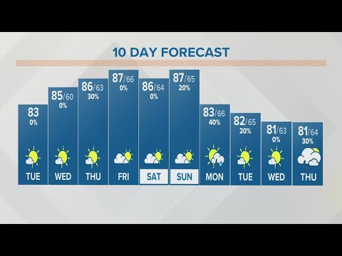
Columbus, Ohio weather forecast | Oct. 24, 2023
Columbus, Ohio weather forecast | Oct. 24, 2023
00:02:38 - Youtube video: MseM6AF_GBs