Loading...
Related Footage
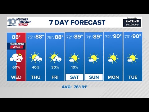
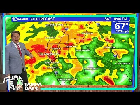
Tracking showers and storms expected across the Tampa Bay area
Tracking showers and storms expected across the Tampa Bay area
00:23:08 - Youtube video: eUy0kAnU6nM
Chief Meteorologist Bobby Deskins tracks storms moving across Tampa Bay
Chief Meteorologist Bobby Deskins tracks storms moving across Tampa Bay
00:09:07 - Youtube video: bJplHSHfw14
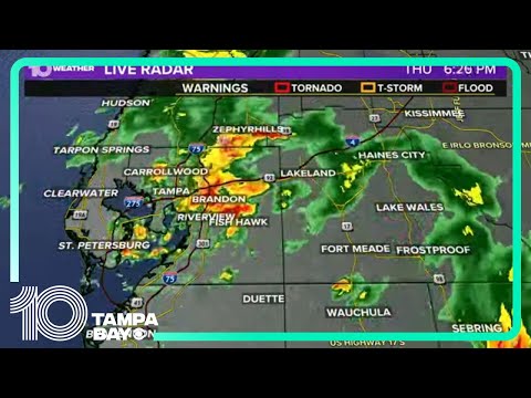
Tracking showers and storms across Tampa Bay area
Tracking showers and storms across Tampa Bay area
00:27:44 - Youtube video: 90AATNwTpN0
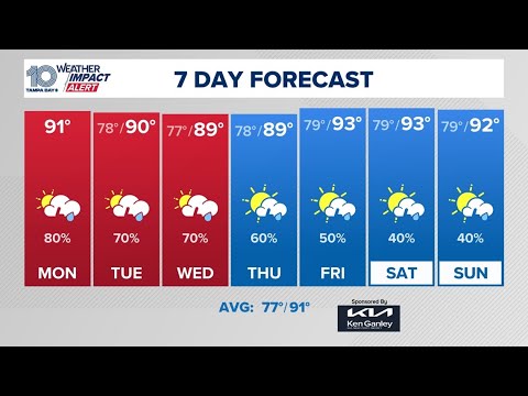
Tracking storms, showers across Tampa Bay region
Tracking storms, showers across Tampa Bay region
02:28:38 - Youtube video: uolI3ePjGDc
Chief meteorologist Bobby Deskins has the latest on powerful storms expected tomorrow
Chief meteorologist Bobby Deskins has the latest on powerful storms expected tomorrow
00:09:36 - Youtube video: 0KrKkjeVhNo
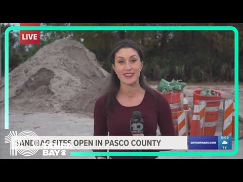
Sandbag sites open in Pasco County ahead of weekend storms
Sandbag sites open in Pasco County ahead of weekend storms
00:01:52 - Youtube video: TqwB8iPJsjE
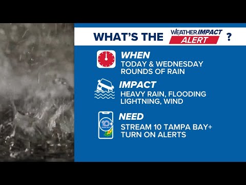
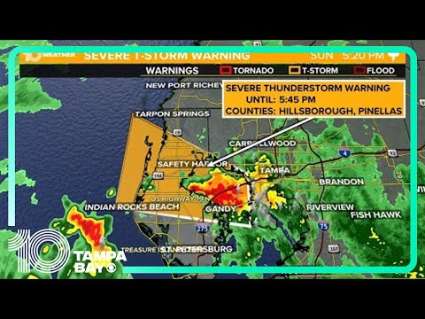
Tracking strong storms, heavy rain moving across Tampa Bay
Tracking strong storms, heavy rain moving across Tampa Bay
00:23:16 - Youtube video: P2FckJlaUVo
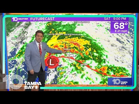
Powerful Florida storm to bring coastal flood threat, possible severe weather
Powerful Florida storm to bring coastal flood threat, possible severe weather
00:12:49 - Youtube video: E2wqBA7ZEjA