Loading...
Related Footage
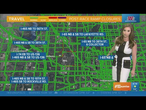
Race day traffic 6 a.m. UPDATE | Track Team 13
Race day traffic 6 a.m. UPDATE | Track Team 13
00:00:47 - Youtube video: J6ytdnGuT_Q
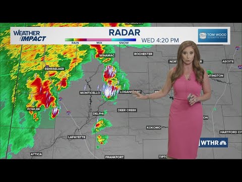
13Weather Forecast | 4 p.m. update, July 30, 2025
13Weather Forecast | 4 p.m. update, July 30, 2025
00:02:49 - Youtube video: a90le-28CEA
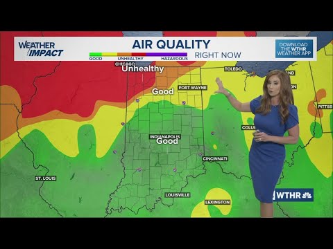
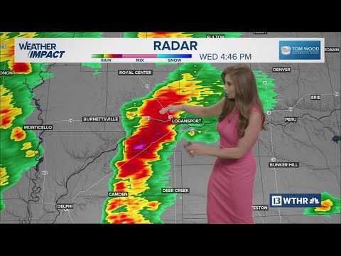
13Weather Forecast | 4:30 p.m. update, July 31, 2025
13Weather Forecast | 4:30 p.m. update, July 31, 2025
00:03:58 - Youtube video: CadRV41CAfo
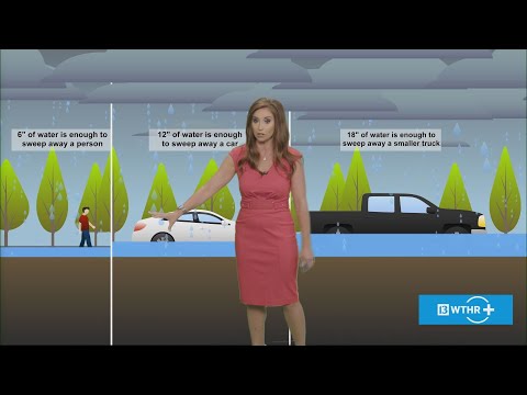
Inside the National Weather Service: How flash floods are tracked & predicted | Outside the Forecast
Inside the National Weather Service: How flash floods are tracked & predicted | Outside the Forecast
00:15:15 - Youtube video: v46XetqiPD4
13Weather Forecast | 4:30 p.m. update, July 30, 2025
13Weather Forecast | 4:30 p.m. update, July 30, 2025
00:02:53 - Youtube video: PUJHHG8i0Wk
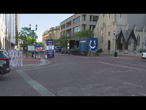
Indianapolis preparing for 2025 Salesforce & JPMorganChase 500 Festival Rookie Run
Indianapolis preparing for 2025 Salesforce & JPMorganChase 500 Festival Rookie Run
00:01:50 - Youtube video: YKZjIr2rrps

13 Weather Academy visits students at Abraham Lincoln Elementary School
13 Weather Academy visits students at Abraham Lincoln Elementary School
00:00:47 - Youtube video: _DEf0_q12YI
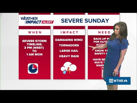
Weather Impact Alert day issued for severe storms across Indiana Sunday
Weather Impact Alert day issued for severe storms across Indiana Sunday
00:09:54 - Youtube video: HZhhdOrygPA