Loading...
Related Footage

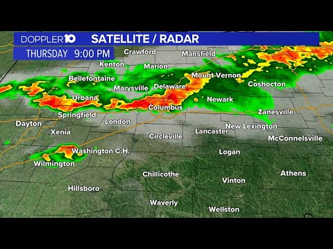
LIVE: Doppler 10 radar active as storms move through central Ohio
LIVE: Doppler 10 radar active as storms move through central Ohio
04:11:02 - Youtube video: zDKXTD5wj6o

Doppler 10 live radar active as storms move through central Ohio
Doppler 10 live radar active as storms move through central Ohio
02:46:40 - Youtube video: lvv4DRZiNaM

Doppler 10 Live Radar: Strong storms move through central Ohio
Doppler 10 Live Radar: Strong storms move through central Ohio
06:15:24 - Youtube video: j4GOyGDY3UE
LIVE RADAR: Doppler 10 tracking the strong storms moving through central Ohio
LIVE RADAR: Doppler 10 tracking the strong storms moving through central Ohio
01:43:40 - Youtube video: nSqFXUiISyo
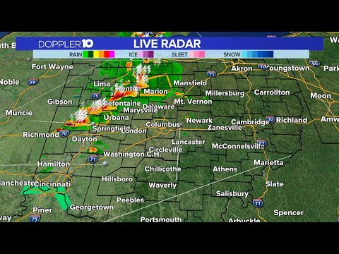
Doppler 10 radar shows strong storms moving through central Ohio
Doppler 10 radar shows strong storms moving through central Ohio
03:38:12 - Youtube video: 65GD9o2OkRU