Loading...
Related Footage
Live Doppler 13 Radar
Live Doppler 13 Radar
08:20:27 - Youtube video: Am8ChroPv-c
Snow Trails gearing up for their winter season
Snow Trails gearing up for their winter season
00:00:48 - Youtube video: AvCB5XE5Qso
Weather Impact
Weather Impact
02:48:05 - Youtube video: HYOAvSkq71w

Snow in October
Snow in October
00:00:46 - Youtube video: 1p0dgM00ynI

Doppler 10 radar: Snow moving across central Ohio
Doppler 10 radar: Snow moving across central Ohio
02:46:49 - Youtube video: f4-8UJOHjdw
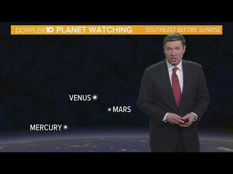
Skywatch: Look for the full moon this week
Skywatch: Look for the full moon this week
00:01:34 - Youtube video: VSnysm_uz3E

ODOT crews preparing roads for snow during Winter Weather Advisory
ODOT crews preparing roads for snow during Winter Weather Advisory
00:01:34 - Youtube video: VzfpIVPF_xE
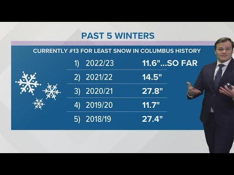
Why hasn't central Ohio received much snow?
Why hasn't central Ohio received much snow?
00:01:46 - Youtube video: YPSMlGmbwrM