Loading...
Related Footage
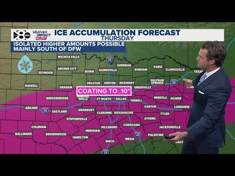
DFW Weather: Latest forecast and timeline for snow, ice this week
DFW Weather: Latest forecast and timeline for snow, ice this week
00:05:12 - Youtube video: z1_Bt9aXdpo
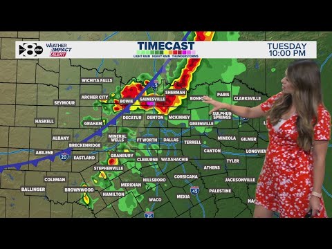
DFW Weather: Latest forecast and timeline for storm chances in North Texas
DFW Weather: Latest forecast and timeline for storm chances in North Texas
00:03:35 - Youtube video: ksiIUlSAKxI
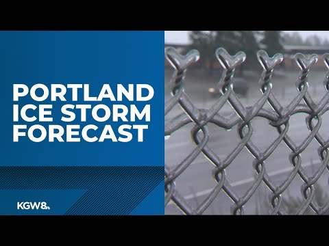
Portland ice storm: Timeline, what to expect | Live stream
Portland ice storm: Timeline, what to expect | Live stream
00:17:42 - Youtube video: DbVfInlaDvA
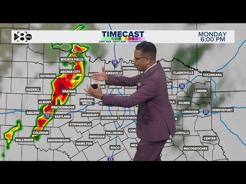
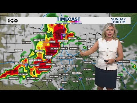
DFW Weather: Latest forecast and timeline for storm chances in North Texas
DFW Weather: Latest forecast and timeline for storm chances in North Texas
00:03:44 - Youtube video: 27toFrBY05Y
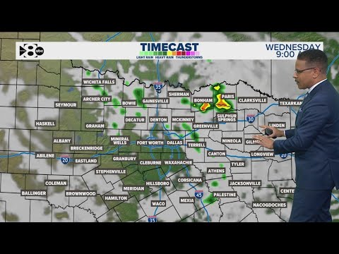
DFW Weather: Latest forecast and timeline for storm chances in North Texas
DFW Weather: Latest forecast and timeline for storm chances in North Texas
00:03:53 - Youtube video: kzyTeHkyYho
DFW Weather: Latest forecast and timeline for rain storm chances in North Texas this week
DFW Weather: Latest forecast and timeline for rain storm chances in North Texas this week
00:03:28 - Youtube video: YtVtEmKOXTQ
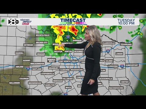
DFW Weather: When will it storm this weekend? Could it be severe? Here's the full forecast
DFW Weather: When will it storm this weekend? Could it be severe? Here's the full forecast
00:04:15 - Youtube video: 92oqmFVZmLI
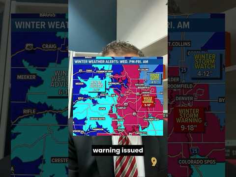
Colorado snowstorm update: Winter Storm Warning issued for Denver metro (Pt.1)
Colorado snowstorm update: Winter Storm Warning issued for Denver metro (Pt.1)
00:00:56 - Youtube video: 3w0CYlSFaA0