Loading...
Related Footage
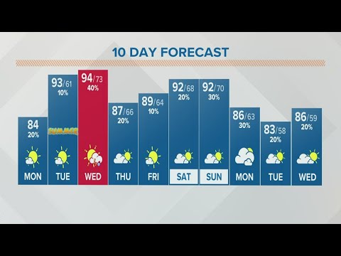
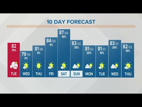
Columbus, Ohio weather forecast | June 20, 2022
Columbus, Ohio weather forecast | June 20, 2022
00:05:00 - Youtube video: zRBzSSHQigo
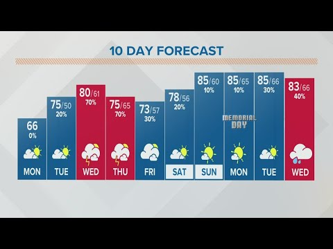
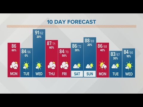
Columbus, Ohio weather forecast | May 23, 2022
Columbus, Ohio weather forecast | May 23, 2022
00:03:06 - Youtube video: kox3ij5GA3Q
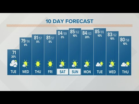
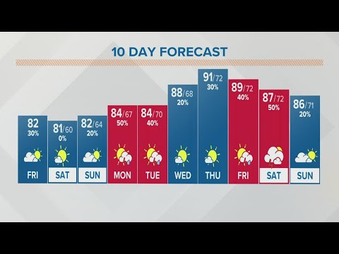
Columbus, Ohio weather forecast | September 13, 2022
Columbus, Ohio weather forecast | September 13, 2022
00:03:43 - Youtube video: Z-gZ1sN_5zA
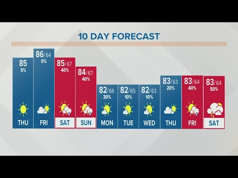
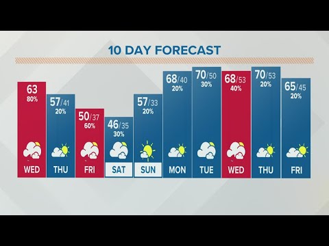
Columbus, Ohio weather forecast | September 1, 2022
Columbus, Ohio weather forecast | September 1, 2022
00:02:13 - Youtube video: 8H9gnw9Azb4
Columbus, Ohio weather forecast | August 30, 2022
Columbus, Ohio weather forecast | August 30, 2022
00:03:05 - Youtube video: u3zfU6wln2E
Columbus, Ohio weather forecast | August 1, 2022
Columbus, Ohio weather forecast | August 1, 2022
00:03:36 - Youtube video: l-dAcuZScxg
Columbus, Ohio weather forecast | July 29, 2022
Columbus, Ohio weather forecast | July 29, 2022
00:03:48 - Youtube video: ilXjb5nupn8
Columbus, Ohio weather forecast | April 6, 2022
Columbus, Ohio weather forecast | April 6, 2022
00:04:15 - Youtube video: kQKNLXAObHI