Loading...
Related Footage
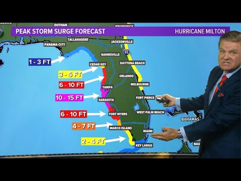
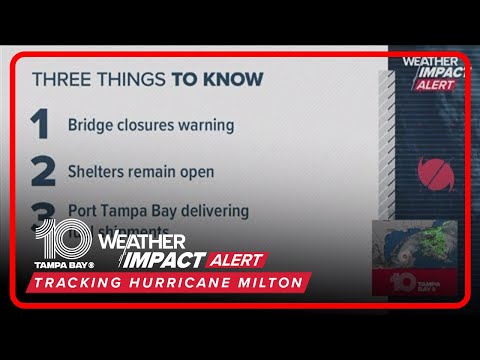
Tracking Hurricane Milton | What to expect as the storm makes landfall
Tracking Hurricane Milton | What to expect as the storm makes landfall
00:03:59 - Youtube video: bVIr5sQYd60
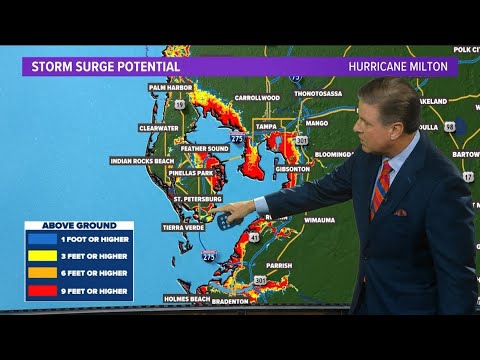
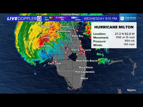
UPDATE: Hurricane Milton | What we are tracking on monday
UPDATE: Hurricane Milton | What we are tracking on monday
00:03:56 - Youtube video: XD2BBQkq_vE
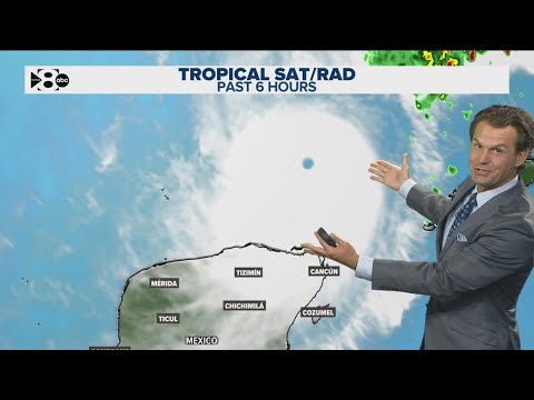
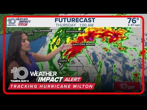
Tracking Hurricane Milton | Storm to make landfall late Wednesday night
Tracking Hurricane Milton | Storm to make landfall late Wednesday night
00:04:15 - Youtube video: SvHUiA2-nf0
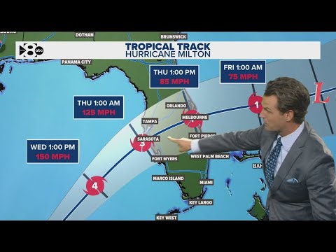
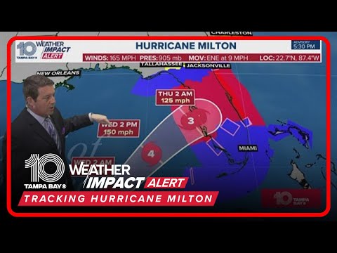
Tracking Hurricane Milton: Projected landfall on Florida's Gulf Coast Wednesday night.
Tracking Hurricane Milton: Projected landfall on Florida's Gulf Coast Wednesday night.
00:05:28 - Youtube video: jRdJeOkHuQk
Tracking Milton: Special coverage from 10 Tampa Bay
Tracking Milton: Special coverage from 10 Tampa Bay
00:04:12 - Youtube video: pdgxjDlmc-Q
Tracking Hurricane Milton
Tracking Hurricane Milton
00:06:44 - Youtube video: uPu-cpHEin4
Tracking Milton: When will the hurricane make landfall in Florida? The latest track and updates
Tracking Milton: When will the hurricane make landfall in Florida? The latest track and updates
00:09:21 - Youtube video: TqUTPgw9yTs
Tracking Hurricane Milton: The latest updates and forecast (6PM)
Tracking Hurricane Milton: The latest updates and forecast (6PM)
00:09:09 - Youtube video: vqeL__Aa104