Loading...
Related Footage
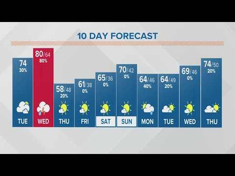
Columbus, Ohio forecast | Warm today, rain tomorrow
Columbus, Ohio forecast | Warm today, rain tomorrow
00:03:23 - Youtube video: ylwPCKHd5AE
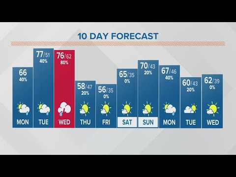
Columbus, Ohio weather forecast | April 4, 2023
Columbus, Ohio weather forecast | April 4, 2023
00:03:44 - Youtube video: 6OFO6MwGJCs
Columbus, Ohio weather forecast | April 3, 2023
Columbus, Ohio weather forecast | April 3, 2023
00:03:24 - Youtube video: Y1AmH7yrmiI
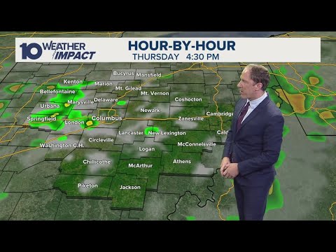
Columbus, Ohio forecast | Rain moving through central Ohio
Columbus, Ohio forecast | Rain moving through central Ohio
00:02:42 - Youtube video: e3DCWKwvnvw
Columbus, Ohio weather forecast | Nov. 15, 2022
Columbus, Ohio weather forecast | Nov. 15, 2022
00:04:58 - Youtube video: 1mtSTvAY7i8

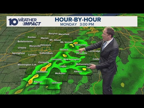
Columbus, Ohio forecast | Some stray showers this morning
Columbus, Ohio forecast | Some stray showers this morning
00:03:20 - Youtube video: KC2UXcCO9Yk

Columbus, Ohio weather forecast | Feb. 27, 2023
Columbus, Ohio weather forecast | Feb. 27, 2023
00:03:41 - Youtube video: 0galfnKTY_U

Columbus, Ohio weather forecast | March 10, 2023
Columbus, Ohio weather forecast | March 10, 2023
00:04:34 - Youtube video: RDs8d9mgaOw