Loading...
Related Footage

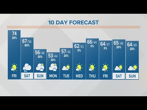
Columbus, Ohio morning weather forecast | Sept. 22, 2023
Columbus, Ohio morning weather forecast | Sept. 22, 2023
00:02:38 - Youtube video: aX7Wlz0X1Wk

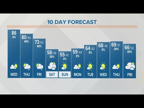
Columbus, Ohio weather forecast | Oct. 13, 2023
Columbus, Ohio weather forecast | Oct. 13, 2023
00:02:48 - Youtube video: qVLvM2WV68o
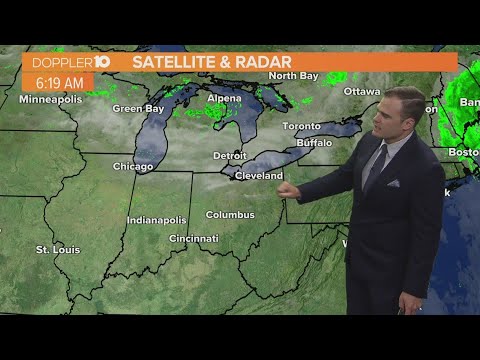
Columbus, Ohio Weather: Pleasant end to the week; rainy start to the weekend
Columbus, Ohio Weather: Pleasant end to the week; rainy start to the weekend
00:02:05 - Youtube video: UPFLQdfbx1o
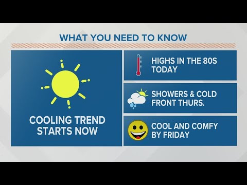
Columbus, Ohio weather forecast | Oct. 4, 2023
Columbus, Ohio weather forecast | Oct. 4, 2023
00:03:45 - Youtube video: JXJLGtZgBhE
Columbus, Ohio weather forecast | June 5, 2023
Columbus, Ohio weather forecast | June 5, 2023
00:02:46 - Youtube video: -8ft2gyZTdU

Columbus, Ohio morning weather forecast | Sept. 5, 2023
Columbus, Ohio morning weather forecast | Sept. 5, 2023
00:03:31 - Youtube video: xAFbRRlnDvE
Columbus, Ohio weather forecast | Sept. 6, 2023
Columbus, Ohio weather forecast | Sept. 6, 2023
00:03:21 - Youtube video: znXzgNWMTPw

Columbus, Ohio morning weather forecast | Chance of strong storms this evening
Columbus, Ohio morning weather forecast | Chance of strong storms this evening
00:03:53 - Youtube video: mDVcfD1RwO4