Loading...
Related Footage

Tracking severe weather in central Ohio | May 21, 2022
Tracking severe weather in central Ohio | May 21, 2022
00:45:48 - Youtube video: 7UhtRpyBWwA

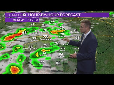
Tracking the second round of storms moving into central Ohio
Tracking the second round of storms moving into central Ohio
04:59:14 - Youtube video: MYTnqpCN2RI

Tornado warnings issued for parts of central Ohio | Tracking Severe Weather
Tornado warnings issued for parts of central Ohio | Tracking Severe Weather
01:28:46 - Youtube video: zJKm2bk2Jmk
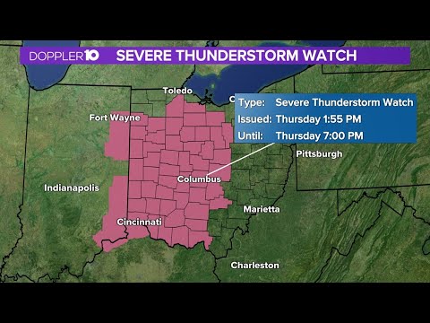
Tracking severe weather in central Ohio: Thunderstorm watches in effect until 7PM
Tracking severe weather in central Ohio: Thunderstorm watches in effect until 7PM
00:03:38 - Youtube video: j8bJealcMAg
Tracking threat of severe storms across central Ohio
Tracking threat of severe storms across central Ohio
00:03:27 - Youtube video: 8ssI6veD3yY
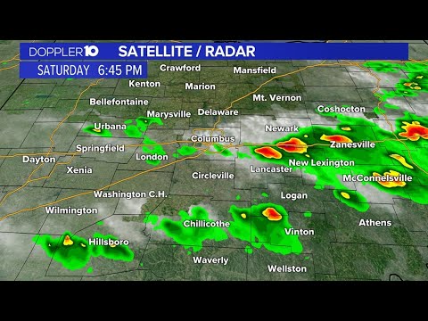
Tracking severe weather in central Ohio
Tracking severe weather in central Ohio
02:23:40 - Youtube video: 5Burky-CZmE
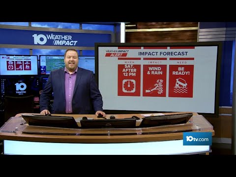
The 10 WEATHER IMPACT Show | July 18, 2025
The 10 WEATHER IMPACT Show | July 18, 2025
00:19:04 - Youtube video: GGZta41cXQs

Live weather updates | Tracking storms moving through central Ohio
Live weather updates | Tracking storms moving through central Ohio
06:11:31 - Youtube video: 3bDMlXBWJvI