Loading...
Related Footage
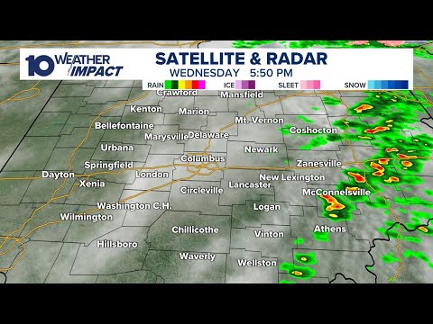
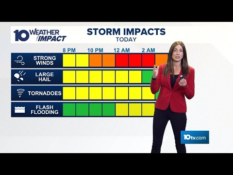
LIVE RADAR: Severe weather in Ohio; strong winds, tornadoes possible
LIVE RADAR: Severe weather in Ohio; strong winds, tornadoes possible
11:54:56 - Youtube video: 9bRJIgbGPJ0
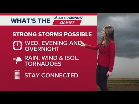
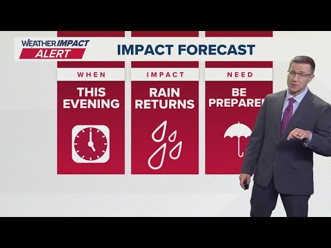
Columbus, Ohio weather forecast for April 2, 2025 | Tracking threat of flooding, isolated tornadoes
Columbus, Ohio weather forecast for April 2, 2025 | Tracking threat of flooding, isolated tornadoes
00:04:22 - Youtube video: xMZz-eP4bhY
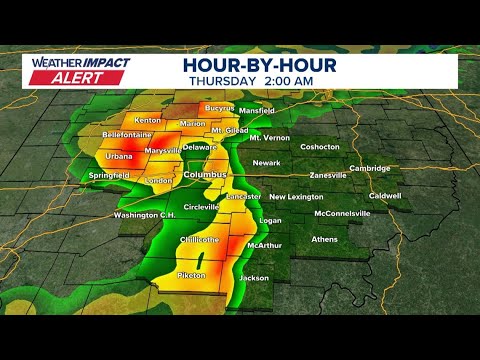
LIVE RADAR: Tracking heavy rain, strong winds moving into central Ohio
LIVE RADAR: Tracking heavy rain, strong winds moving into central Ohio
07:21:59 - Youtube video: EJ_Hjp7RqIw
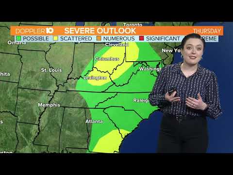
Columbus, Ohio weather forecast: Rain and storms ahead | Wednesday, April 10
Columbus, Ohio weather forecast: Rain and storms ahead | Wednesday, April 10
00:03:25 - Youtube video: Zs_Rgl0SmG4
Severe weather outlook: Tracking strong storms in Columbus, OH | THE 10 WEATHER IMPACT Show (4-2-25)
Severe weather outlook: Tracking strong storms in Columbus, OH | THE 10 WEATHER IMPACT Show (4-2-25)
00:10:29 - Youtube video: yIVq-_k5vqY
Columbus, Ohio weather forecast for April 3, 2025 | Storms moving out, but more rain this evening
Columbus, Ohio weather forecast for April 3, 2025 | Storms moving out, but more rain this evening
00:04:50 - Youtube video: rlSdrWNtiR8
Columbus, Ohio forecast | Rain today, possible storms Sunday
Columbus, Ohio forecast | Rain today, possible storms Sunday
00:02:53 - Youtube video: Y_2j5Bwh8Bc
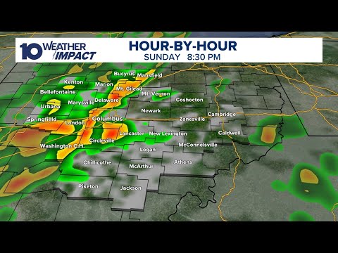
Tracking possible severe storms in central Ohio
Tracking possible severe storms in central Ohio
01:15:13 - Youtube video: 3NZaeXNDrAE