Loading...
Related Footage
Weekend Forecast: Sunday, Oct. 6
Weekend Forecast: Sunday, Oct. 6
00:03:04 - Youtube video: QNHBCqq3qZo

Colorado weather: Why warm winter days aren’t that rare in Denver
Colorado weather: Why warm winter days aren’t that rare in Denver
00:00:49 - Youtube video: clHKNdy7_Jw
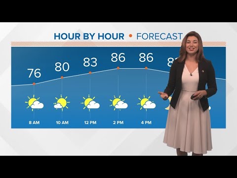
13Weather Forecast | 5 p.m. update, Aug. 22, 2025
13Weather Forecast | 5 p.m. update, Aug. 22, 2025
00:02:49 - Youtube video: gvIPaSV10Sc
13Weather Forecast | 5:30 p.m. update, Aug. 22, 2025
13Weather Forecast | 5:30 p.m. update, Aug. 22, 2025
00:02:14 - Youtube video: lCPVyOHRd7o

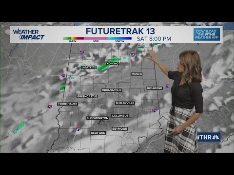
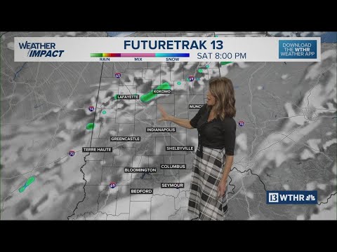
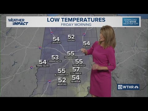
Weather Impact Alert days through Friday for heat, storm chances | 13Weather Extended Forecast
Weather Impact Alert days through Friday for heat, storm chances | 13Weather Extended Forecast
00:07:26 - Youtube video: wMSkFvyAmkk
Sunday Night Weather Forecast
Sunday Night Weather Forecast
00:02:36 - Youtube video: hGKVWyTqco4

LIVE RADAR | Tracking DFW Weather and storm chances Monday
LIVE RADAR | Tracking DFW Weather and storm chances Monday
10:08:12 - Youtube video: UXdJPP2XcmA
13Weather Forecast | 5 p.m. update, Sept. 25, 2025
13Weather Forecast | 5 p.m. update, Sept. 25, 2025
00:02:18 - Youtube video: 0IRys7rVviY