Loading...
Related Footage
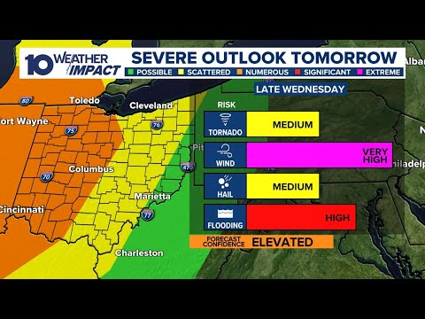
Tracking damaging winds, heavy rain expected Wednesday in central Ohio
Tracking damaging winds, heavy rain expected Wednesday in central Ohio
00:37:04 - Youtube video: cB7zk8qNowY
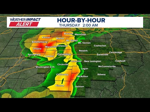
LIVE RADAR: Tracking heavy rain, strong winds moving into central Ohio
LIVE RADAR: Tracking heavy rain, strong winds moving into central Ohio
07:21:59 - Youtube video: EJ_Hjp7RqIw
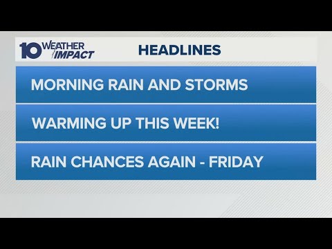
Columbus, Ohio weather forecast for April 21, 2025 | Early morning showers but warming up
Columbus, Ohio weather forecast for April 21, 2025 | Early morning showers but warming up
00:03:09 - Youtube video: 1wiNN_KVU2U