Loading...
Related Footage
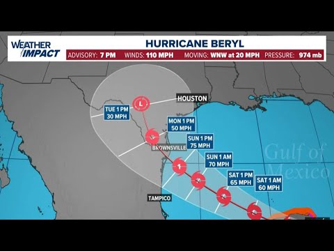
Hurricane Beryl live tracker: Track models, projected path and satellite images
Hurricane Beryl live tracker: Track models, projected path and satellite images
09:57:37 - Youtube video: MVC0wrda-zI

Hurricane Beryl live tracker: Track models, projected path and satellite images
Hurricane Beryl live tracker: Track models, projected path and satellite images
11:55:00 - Youtube video: _kjAKASslds