Loading...
Related Footage
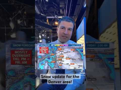
Denver snow update!
Denver snow update!
00:00:58 - Youtube video: SrTA3_LEbsk
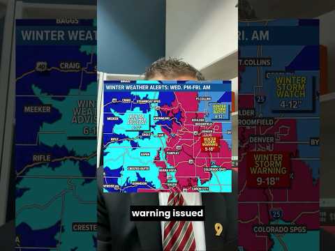
Colorado snowstorm update: Winter Storm Warning issued for Denver metro (Pt.1)
Colorado snowstorm update: Winter Storm Warning issued for Denver metro (Pt.1)
00:00:56 - Youtube video: 3w0CYlSFaA0

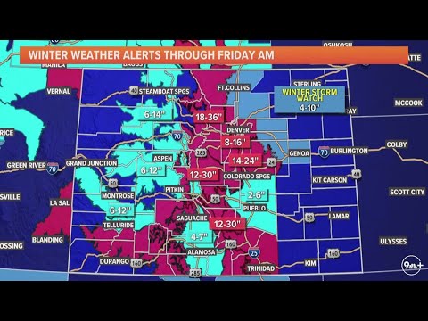
Latest headlines | Winter Storm Warning in Colorado: How much snow could Denver get?
Latest headlines | Winter Storm Warning in Colorado: How much snow could Denver get?
00:11:27 - Youtube video: xbZ1iV1taMY
Light snow continues in Denver
Light snow continues in Denver
03:00:04 - Youtube video: YvdqnPMpr_M
Latest updates on the snowstorm hitting Colorado
Latest updates on the snowstorm hitting Colorado
00:14:57 - Youtube video: obGsroIfFuw
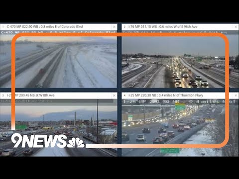
LIVE: Slick, icy roads across Denver during Tuesday morning commute
LIVE: Slick, icy roads across Denver during Tuesday morning commute
03:06:58 - Youtube video: Mmt5ppk6Q6M
Major winter storm headed for Colorado
Major winter storm headed for Colorado
00:08:40 - Youtube video: _5z6-4Dth2Q
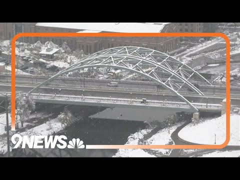
Colorado snow: November storm continues across the Denver metro
Colorado snow: November storm continues across the Denver metro
03:29:42 - Youtube video: On4YTruj5f0