Loading...
Related Footage
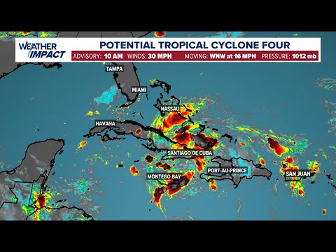
Tropics tracker: Potential Tropical Cyclone Four continues to develop in the Atlantic
Tropics tracker: Potential Tropical Cyclone Four continues to develop in the Atlantic
07:51:55 - Youtube video: VHTLA5ftUrc
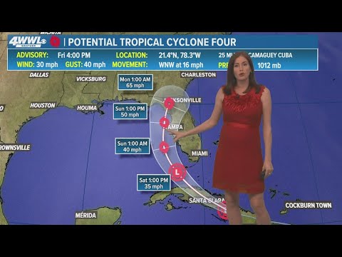
Friday 5 PM Tropical Update: Tracking PTC 4 heading toward Florida
Friday 5 PM Tropical Update: Tracking PTC 4 heading toward Florida
00:01:19 - Youtube video: lh5uVcsRijo
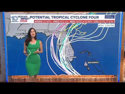
Potential Tropical Cyclone Four to track toward Florida
Potential Tropical Cyclone Four to track toward Florida
00:08:34 - Youtube video: TCwovAVtAGY