Loading...
Related Footage

LIVE RADAR: Showers and storms moving through Tampa Bay area
LIVE RADAR: Showers and storms moving through Tampa Bay area
01:21:47 - Youtube video: ynx9jQ_I6u4
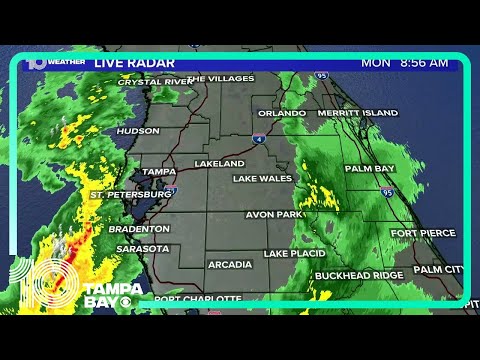
LIVE RADAR: Potential flooding concerns as scattered showers and storms move through the area
LIVE RADAR: Potential flooding concerns as scattered showers and storms move through the area
06:23:57 - Youtube video: -PwfpfF2Ed0
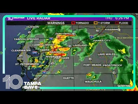
Chief Meteorologist Bobby Deskins tracks storms moving across Tampa Bay
Chief Meteorologist Bobby Deskins tracks storms moving across Tampa Bay
00:09:07 - Youtube video: bJplHSHfw14
LIVE RADAR | Showers, storms move across Tampa Bay area
LIVE RADAR | Showers, storms move across Tampa Bay area
02:10:28 - Youtube video: b9AMnipTFdg

Scattered showers and storms move across Tampa Bay area
Scattered showers and storms move across Tampa Bay area
01:32:12 - Youtube video: u_1j4EeB4Fo
Tracking storms, showers across Tampa Bay region
Tracking storms, showers across Tampa Bay region
02:28:38 - Youtube video: uolI3ePjGDc
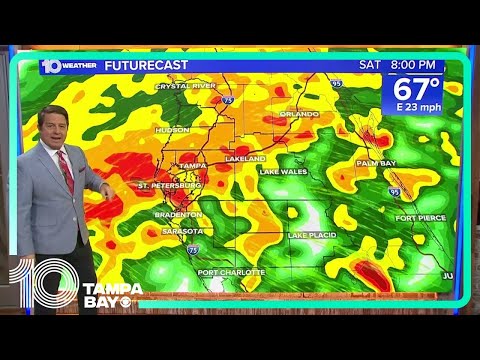
Tracking strong storms, heavy rain moving across Tampa Bay
Tracking strong storms, heavy rain moving across Tampa Bay
00:23:16 - Youtube video: P2FckJlaUVo
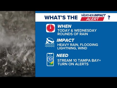
Chief meteorologist Bobby Deskins has the latest on powerful storms expected tomorrow
Chief meteorologist Bobby Deskins has the latest on powerful storms expected tomorrow
00:09:36 - Youtube video: 0KrKkjeVhNo