Loading...
Related Footage
Tropical Storm Hilary forms off Mexico's southern Pacific coast
Tropical Storm Hilary forms off Mexico's southern Pacific coast
00:03:22 - Youtube video: iv_DRIG8bBs

Will Oregon get a break from the smoke? And where's former Hurricane Hilary?
Will Oregon get a break from the smoke? And where's former Hurricane Hilary?
00:05:59 - Youtube video: _b7yHbyNSjw
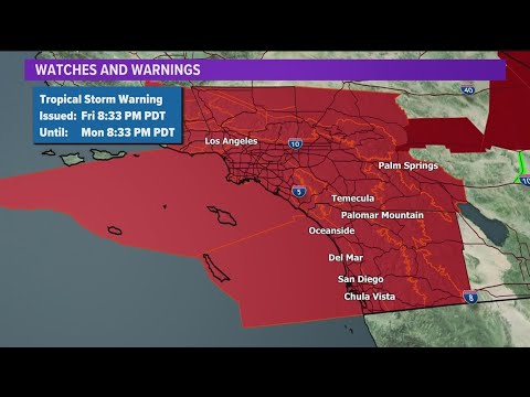
San Diego County under Tropical Storm Warning as Hilary approaches
San Diego County under Tropical Storm Warning as Hilary approaches
00:10:06 - Youtube video: WTp6kTaOQKI

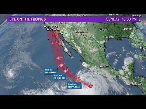
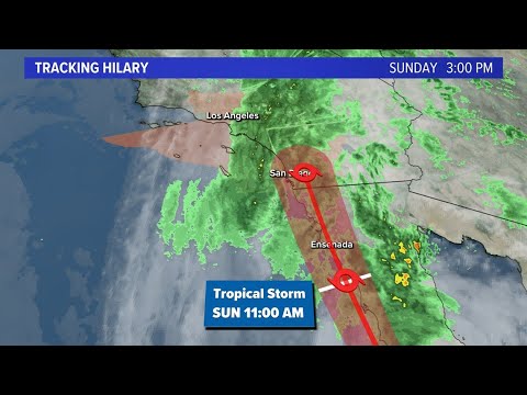
Tracking Hilary | Tropical Storm warning in effect for Southern California
Tracking Hilary | Tropical Storm warning in effect for Southern California
00:15:32 - Youtube video: vOMlyXbZl6g
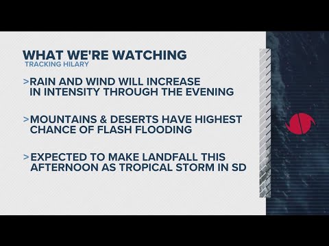
Tracking Hilary across San Diego | Power outages, school closures, Mission Valley and coastal condit
Tracking Hilary across San Diego | Power outages, school closures, Mission Valley and coastal condit
00:15:55 - Youtube video: M9NGxbFDqUA

Portland's record heat could soon be replaced by rain from Tropical Storm Hilary
Portland's record heat could soon be replaced by rain from Tropical Storm Hilary
00:04:12 - Youtube video: weCrlpeU-u0
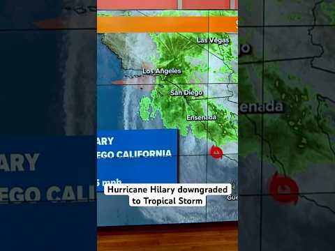
Hurricane Hilary has been downgraded to Tropical Storm Hilary before making landfall in San Diego
Hurricane Hilary has been downgraded to Tropical Storm Hilary before making landfall in San Diego
00:00:48 - Youtube video: 8CnTGm3Wzv0
Tracking Hilary | Once a Category 4 Hurricane, downgraded to tropical storm before hitting CA
Tracking Hilary | Once a Category 4 Hurricane, downgraded to tropical storm before hitting CA
00:11:25 - Youtube video: Elkbuzg7z7k