Loading...
Related Footage
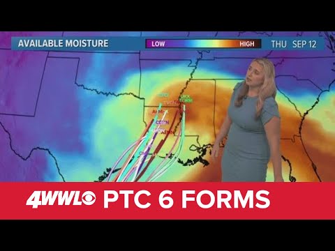
Sunday 5 PM Tropical Update: PTC 6 forms in the southern Gulf, forecast to become hurricane
Sunday 5 PM Tropical Update: PTC 6 forms in the southern Gulf, forecast to become hurricane
00:05:41 - Youtube video: jNPKa0N2VgI
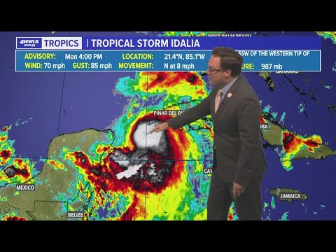
Monday evening tropical update: Idalia forecast to be major hurricane
Monday evening tropical update: Idalia forecast to be major hurricane
00:01:46 - Youtube video: 1eFzbERfbQ4
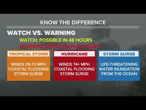
Hurricane Preparedness Week: Understanding a hurricane forecast
Hurricane Preparedness Week: Understanding a hurricane forecast
00:02:12 - Youtube video: VZlaNb3Q3Ko

Thursday 5 AM Tropical Update: Hurricane Ernesto moving north
Thursday 5 AM Tropical Update: Hurricane Ernesto moving north
00:00:35 - Youtube video: jDAu2Q_RQ6Y

Hurricane experts at Colorado State update season forecast
Hurricane experts at Colorado State update season forecast
00:00:34 - Youtube video: MQDuSZsBOxk

Tropical Update: Hurricane Helene expected to strengthen before making impactful landfall
Tropical Update: Hurricane Helene expected to strengthen before making impactful landfall
00:05:05 - Youtube video: g-5-TS93A0s
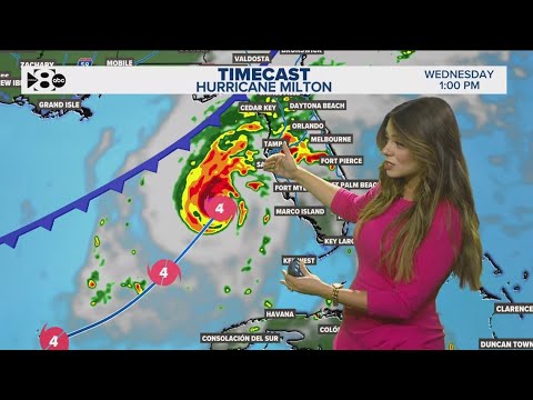
Hurricane Milton tracker: Latest forecast, category, path, spaghetti models Tuesday
Hurricane Milton tracker: Latest forecast, category, path, spaghetti models Tuesday
00:01:41 - Youtube video: EnK7leOt_F4
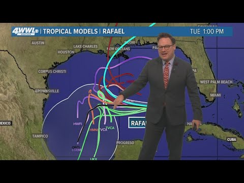
Thursday 5PM Tropical Update: What we now know about Hurricane Rafael
Thursday 5PM Tropical Update: What we now know about Hurricane Rafael
00:04:25 - Youtube video: 8hLTExiX3HY