Loading...
Related Footage
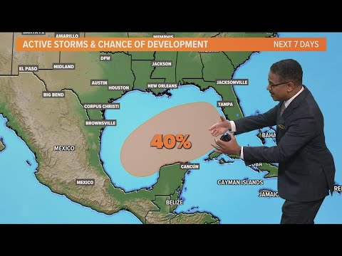
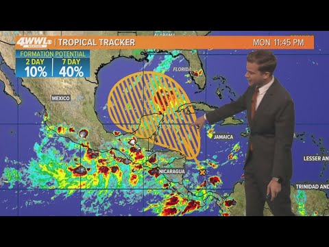
Tropics forecast: Latest storm development chances in the Gulf
Tropics forecast: Latest storm development chances in the Gulf
00:01:02 - Youtube video: o2CLV4Wv4BU
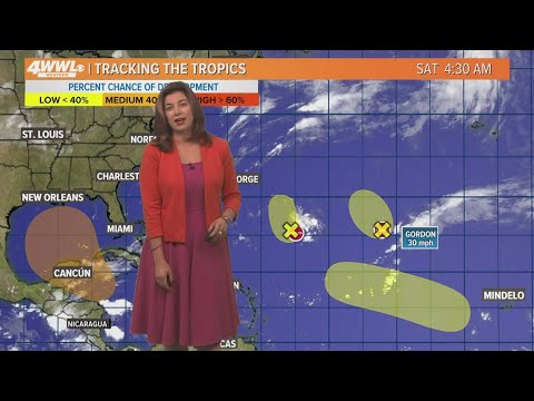
Saturday 7 am Tropical Update: Watching the Gulf of Mexico for development
Saturday 7 am Tropical Update: Watching the Gulf of Mexico for development
00:02:58 - Youtube video: 3IHXMA0XySc
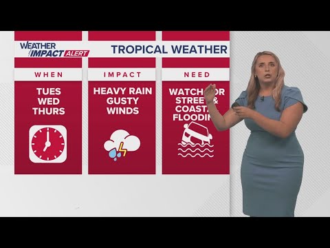
New Orleans Weather: Tropical system forms, expected to bring impacts to Gulf Coast
New Orleans Weather: Tropical system forms, expected to bring impacts to Gulf Coast
00:05:18 - Youtube video: Kzc2YugEn9Q
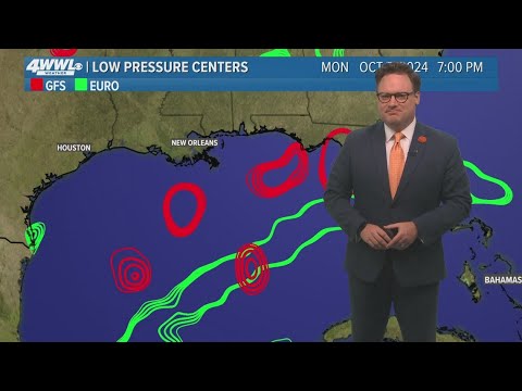
Monday 10PM Tropical Update: Development possible in Gulf of Mexico late this week
Monday 10PM Tropical Update: Development possible in Gulf of Mexico late this week
00:01:36 - Youtube video: myXewi9ozvw
Tuesday 5 AM Tropical Update: Development possible in Gulf of Mexico
Tuesday 5 AM Tropical Update: Development possible in Gulf of Mexico
00:03:24 - Youtube video: -T9azI9usSM
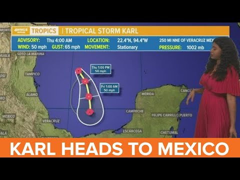
Thursday morning tropical update: Karl heads for Mexico
Thursday morning tropical update: Karl heads for Mexico
00:01:07 - Youtube video: E3yV4N29ROI
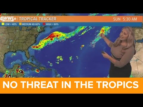
Sunday 8am tropical update: Tropical moisture moving into the Gulf of Mexico this week
Sunday 8am tropical update: Tropical moisture moving into the Gulf of Mexico this week
00:00:47 - Youtube video: RsLVRNWfl5Q
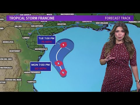
Tropical Storm Francine: Latest forecast, path, Texas impacts, Gulf track
Tropical Storm Francine: Latest forecast, path, Texas impacts, Gulf track
00:03:51 - Youtube video: T2QSS5deDPA