Loading...
Related Footage
New Orleans Weather: Scattered downpours over weekend
New Orleans Weather: Scattered downpours over weekend
00:04:38 - Youtube video: BJjpDYBxsGo

New Orleans flooding: Major highway underwater Wednesday
New Orleans flooding: Major highway underwater Wednesday
00:12:19 - Youtube video: jGhQotH-ofM

High water on New Orleans street strands cars; man rescued from water
High water on New Orleans street strands cars; man rescued from water
00:01:52 - Youtube video: H5n9zCQtzwI

New Orleans Weather: Level 4 threat for severe weather
New Orleans Weather: Level 4 threat for severe weather
00:04:29 - Youtube video: on0vfMvnzT4
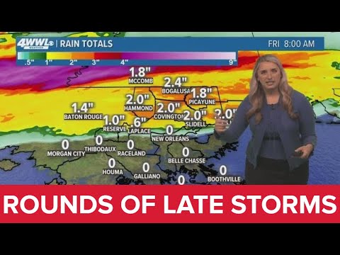
New Orleans Weather: Rounds of storms move in late Thursday night
New Orleans Weather: Rounds of storms move in late Thursday night
00:04:33 - Youtube video: DuGlEgKxNYA

Latest on deadly storms that swept across Southeast Louisiana
Latest on deadly storms that swept across Southeast Louisiana
00:03:09 - Youtube video: jBwhey12wTA
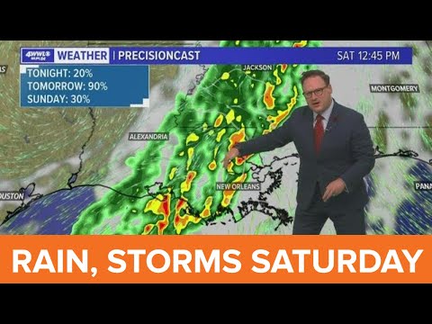
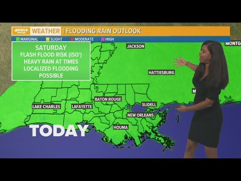
New Orleans Weather: Stormy start to Saturday
New Orleans Weather: Stormy start to Saturday
00:04:08 - Youtube video: ipTHRXxSUW0
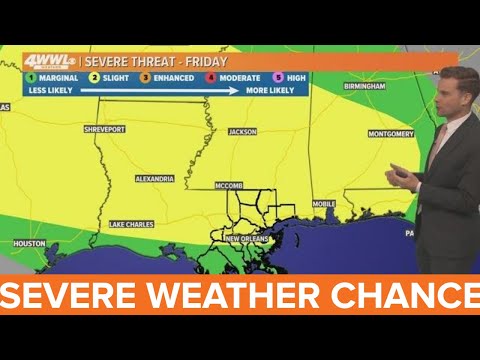
New Orleans Weather: Severe storms possible Friday
New Orleans Weather: Severe storms possible Friday
00:03:10 - Youtube video: XxmoCzr-_-Q