Loading...
Related Footage

Tracking the Tropics: Hurricane Beryl continues to pummel Grand Cayman, sets sights on Cancun
Tracking the Tropics: Hurricane Beryl continues to pummel Grand Cayman, sets sights on Cancun
00:02:44 - Youtube video: awSn946e0Qk
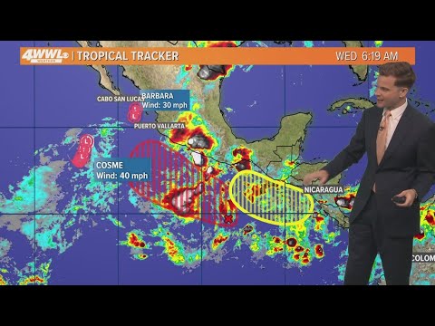
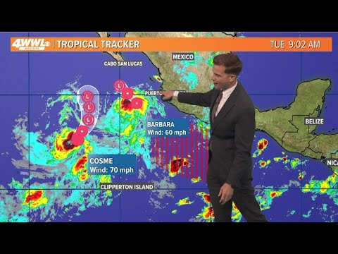
Tracking the Tropics: Saharan dust moves, active Pacific, some systems trying to form
Tracking the Tropics: Saharan dust moves, active Pacific, some systems trying to form
00:00:31 - Youtube video: aDKcPhk83AE
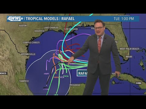
Thursday 5PM Tropical Update: What we now know about Hurricane Rafael
Thursday 5PM Tropical Update: What we now know about Hurricane Rafael
00:04:25 - Youtube video: 8hLTExiX3HY

Tracking the Tropics: Weakened Beryl could gain strength as possible U.S. landfall nears
Tracking the Tropics: Weakened Beryl could gain strength as possible U.S. landfall nears
00:02:28 - Youtube video: d8LSVxdf8QM
Tropical Update: Eye on the Tropics as August comes to a close
Tropical Update: Eye on the Tropics as August comes to a close
00:00:59 - Youtube video: Vu5QwjKoDHg
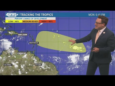
Tracking the Tropics: Nothing brewing yet, but stay alert
Tracking the Tropics: Nothing brewing yet, but stay alert
00:05:26 - Youtube video: GJZwPZKAD7U
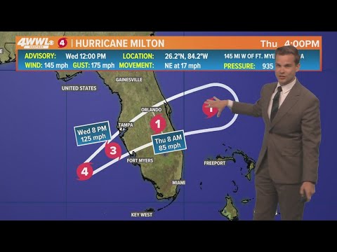
Wednesday 12PM First Weather: Hurricane Milton spawns tornadoes ahead of Florida landfall
Wednesday 12PM First Weather: Hurricane Milton spawns tornadoes ahead of Florida landfall
00:02:10 - Youtube video: gEo2DW73hlk
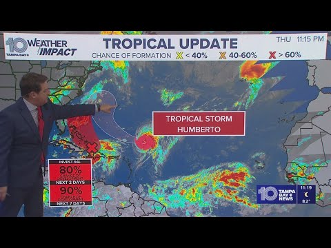
Tracking the Tropics: Humberto forecast to become a major hurricane this weekend
Tracking the Tropics: Humberto forecast to become a major hurricane this weekend
00:01:37 - Youtube video: plrrlrBDIsU