Loading...
Related Footage

Severe Weather update | 9 PM
Severe Weather update | 9 PM
00:06:31 - Youtube video: 0FBH95wg6eI
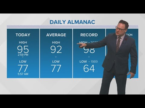
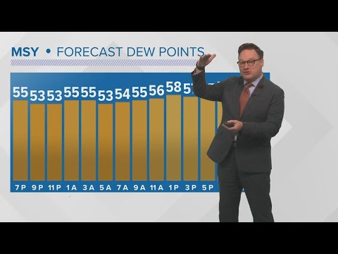
New Orleans Weather: High temps, humidity this week
New Orleans Weather: High temps, humidity this week
00:04:34 - Youtube video: vo6zSpkq1oA
First Weather: Warm New Orleans forecast for Labor Day
First Weather: Warm New Orleans forecast for Labor Day
00:01:44 - Youtube video: O_HBPkHsxDA
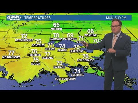
New Orleans weather: warmer temperatures as workweek continues
New Orleans weather: warmer temperatures as workweek continues
00:04:05 - Youtube video: 6I7ZGougSg4
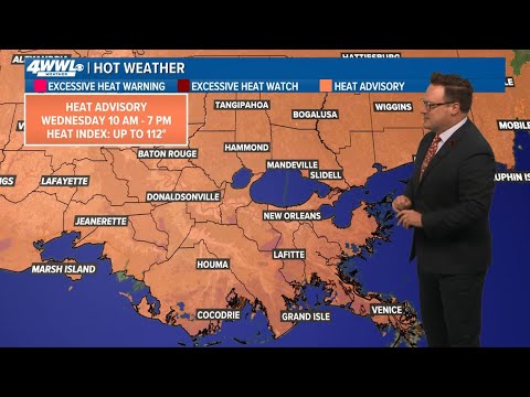
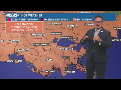
New Orleans Weather: Another Heat Advisory expected on Wednesday
New Orleans Weather: Another Heat Advisory expected on Wednesday
00:02:04 - Youtube video: v5lMIJG914Q
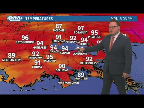
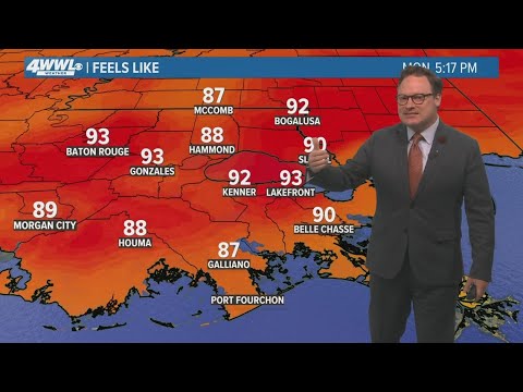
New Orleans Weather: Sizzling temperatures through next week
New Orleans Weather: Sizzling temperatures through next week
00:04:35 - Youtube video: oqcvv8kAxwY
New Orleans Weather: Pleasant weekend ahead
New Orleans Weather: Pleasant weekend ahead
00:04:02 - Youtube video: C92C-AIIguY
New Orleans weather: heavy rain and strong storms expected Wednesday
New Orleans weather: heavy rain and strong storms expected Wednesday
00:04:32 - Youtube video: M1Tz5K8Ksnk