Loading...
Related Footage
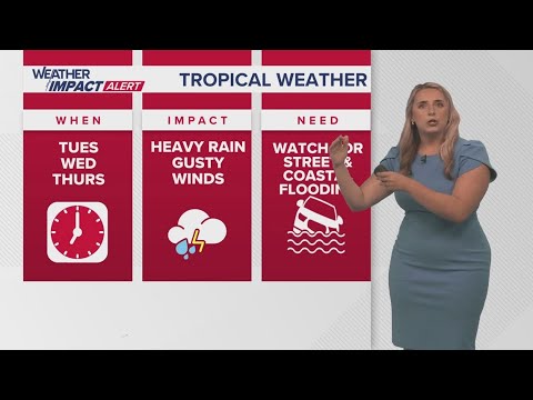
New Orleans Weather: Tropical system forms, expected to bring impacts to Gulf Coast
New Orleans Weather: Tropical system forms, expected to bring impacts to Gulf Coast
00:05:18 - Youtube video: Kzc2YugEn9Q
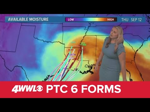
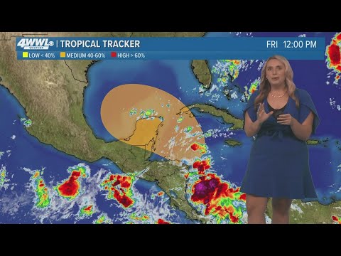
Sunday 5 PM Tropical Update: PTC 6 forms in the southern Gulf, forecast to become hurricane
Sunday 5 PM Tropical Update: PTC 6 forms in the southern Gulf, forecast to become hurricane
00:05:41 - Youtube video: jNPKa0N2VgI
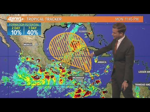
Friday 5 AM Tropical Update: Tropics remain busy, new area to watch in the Caribbean
Friday 5 AM Tropical Update: Tropics remain busy, new area to watch in the Caribbean
00:04:15 - Youtube video: D5-V_G3FFcI
Tuesday 5 AM Tropical Update: Development possible in Gulf of Mexico
Tuesday 5 AM Tropical Update: Development possible in Gulf of Mexico
00:03:24 - Youtube video: -T9azI9usSM
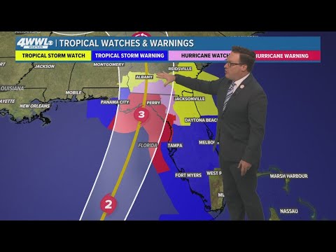
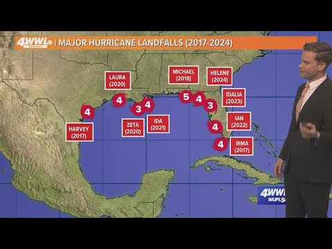
Tropical Storm Helene likely to become major hurricane, headed to Florida
Tropical Storm Helene likely to become major hurricane, headed to Florida
00:03:42 - Youtube video: GoRT-q6L_lA
Friday 12 PM Tropical Update: Watching the Gulf of Mexico
Friday 12 PM Tropical Update: Watching the Gulf of Mexico
00:02:25 - Youtube video: Ojpr-1-L8KM
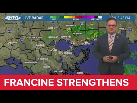
Monday 4PM Tropical Update: Francine expected stronger at landfall, shifts west
Monday 4PM Tropical Update: Francine expected stronger at landfall, shifts west
00:07:40 - Youtube video: 9B8P2hwPC14

Local high wind warning due to Hurricane Ian
Local high wind warning due to Hurricane Ian
00:02:36 - Youtube video: IAWb4FGcq5M