Loading...
Related Footage
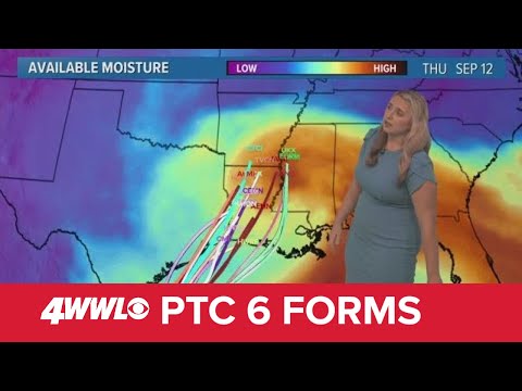
Sunday 5 PM Tropical Update: PTC 6 forms in the southern Gulf, forecast to become hurricane
Sunday 5 PM Tropical Update: PTC 6 forms in the southern Gulf, forecast to become hurricane
00:05:41 - Youtube video: jNPKa0N2VgI
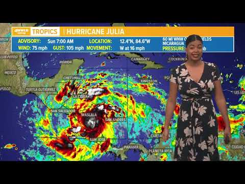
Sunday morning tropical update: Hurricane Julia makes landfall
Sunday morning tropical update: Hurricane Julia makes landfall
00:01:19 - Youtube video: NpU9JqO2LgQ
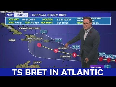
Tropical Storm Bret has formed in the Atlantic
Tropical Storm Bret has formed in the Atlantic
00:04:46 - Youtube video: DPxXYL51Jhs
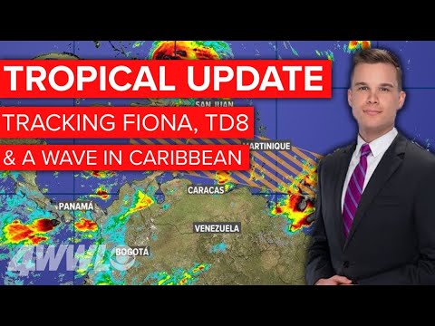
Tuesday morning tropics update: TD 8, Hurricane Fiona & another wave heading towards the Caribbean
Tuesday morning tropics update: TD 8, Hurricane Fiona & another wave heading towards the Caribbean
00:07:53 - Youtube video: N3ue5158Hb4
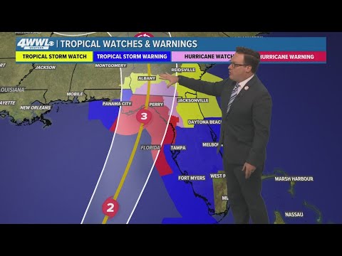
Tropical Storm Helene likely to become major hurricane, headed to Florida
Tropical Storm Helene likely to become major hurricane, headed to Florida
00:03:42 - Youtube video: GoRT-q6L_lA

Francine becomes a category 1 hurricane
Francine becomes a category 1 hurricane
00:05:25 - Youtube video: u2R0u2Nadec
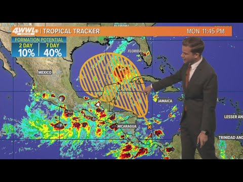
Tuesday 5 AM Tropical Update: Development possible in Gulf of Mexico
Tuesday 5 AM Tropical Update: Development possible in Gulf of Mexico
00:03:24 - Youtube video: -T9azI9usSM
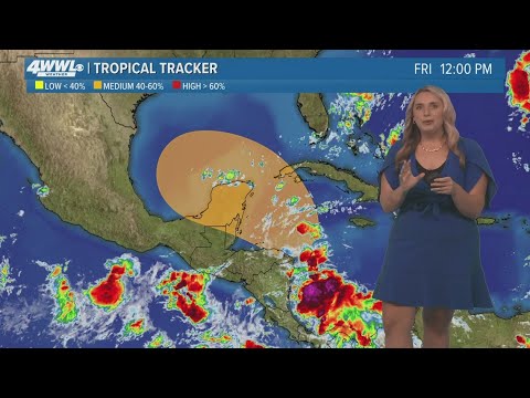
Friday 12 PM Tropical Update: Watching the Gulf of Mexico
Friday 12 PM Tropical Update: Watching the Gulf of Mexico
00:02:25 - Youtube video: Ojpr-1-L8KM