Loading...
Related Footage
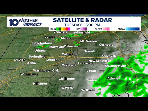
Tracking rain as it moves through central Ohio | Weather updates July 1, 2025
Tracking rain as it moves through central Ohio | Weather updates July 1, 2025
04:10:18 - Youtube video: ttxdJj8A2SE
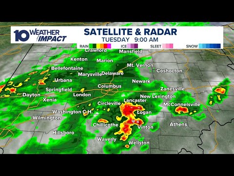
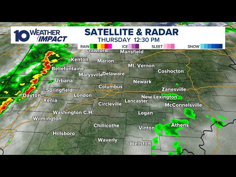
LIVE RADAR: Tracking heavy rain, strong winds moving into central Ohio
LIVE RADAR: Tracking heavy rain, strong winds moving into central Ohio
07:21:59 - Youtube video: EJ_Hjp7RqIw
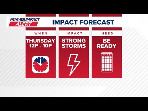
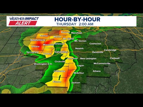
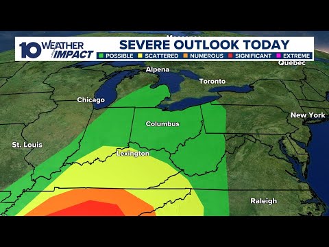
Tracking possible strong storms expected Thursday in central Ohio
Tracking possible strong storms expected Thursday in central Ohio
00:46:30 - Youtube video: jD1nXD6ms_g
Tracking storms and showers in central Ohio | Live weather updates, radar
Tracking storms and showers in central Ohio | Live weather updates, radar
00:00:16 - Youtube video: bTSWyEJ5gJ4
Tracking severe weather moving into central Ohio
Tracking severe weather moving into central Ohio
00:55:13 - Youtube video: AwSRtYZAa2w
Tracking storms moving through central Ohio | Live radar, weather updates
Tracking storms moving through central Ohio | Live radar, weather updates
10:48:01 - Youtube video: PWMav_TO37g
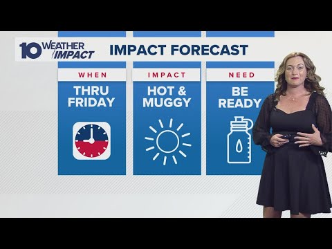
Columbus, Ohio weather forecast for June 12, 2025 | Hot and muggy
Columbus, Ohio weather forecast for June 12, 2025 | Hot and muggy
00:02:29 - Youtube video: CGeufSYW4Tk