Loading...
Related Footage
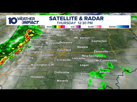
Tracking storms moving through central Ohio | Live radar, weather updates
Tracking storms moving through central Ohio | Live radar, weather updates
10:48:01 - Youtube video: PWMav_TO37g
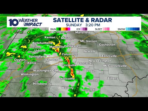
LIVE RADAR | Tracking threat of severe weather in central Ohio; Heavy rain & high winds expected
LIVE RADAR | Tracking threat of severe weather in central Ohio; Heavy rain & high winds expected
09:06:10 - Youtube video: UmagFV5ANCw
LIVE: Weather Impact Alert live updates and radar
LIVE: Weather Impact Alert live updates and radar
11:54:58 - Youtube video: NyqjL-xGIMw

WATCH LIVE: Storms move across Upper Midwest
WATCH LIVE: Storms move across Upper Midwest
02:06:06 - Youtube video: ErkHY-wjNHM
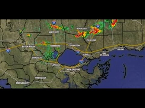
LIVE: Severe Weather in Southeast Louisiana | Tracking rain, storms
LIVE: Severe Weather in Southeast Louisiana | Tracking rain, storms
05:23:30 - Youtube video: tqbwF8zcjzA
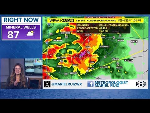
LIVE RADAR: Parts of North Texas under a Tornado Watch on Wednesday
LIVE RADAR: Parts of North Texas under a Tornado Watch on Wednesday
00:18:04 - Youtube video: eOzwMfMuFFM
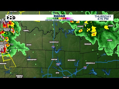
LIVE: Severe storms developing in North Texas on Thursday
LIVE: Severe storms developing in North Texas on Thursday
11:54:56 - Youtube video: 545rElEQ_Fc
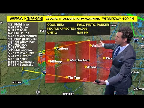
DFW weather: Update on what to expect on Wednesday
DFW weather: Update on what to expect on Wednesday
00:05:04 - Youtube video: 0wXRrY43fNY