Loading...
Related Footage
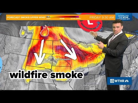
Wildfire smoke from Canada surging south this weekend (May 30-31)
Wildfire smoke from Canada surging south this weekend (May 30-31)
00:04:09 - Youtube video: PrB4I1n7aCw

THE BEAT with Austin & Birm (6/5/25) | Ohio State Football podcast
THE BEAT with Austin & Birm (6/5/25) | Ohio State Football podcast
00:29:23 - Youtube video: vuehEnOxBrw
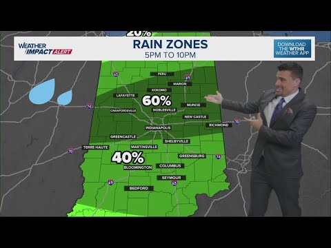
Scattered downpour chances increase today across central Indiana | Low severe wind risk
Scattered downpour chances increase today across central Indiana | Low severe wind risk
00:03:30 - Youtube video: 70ykJ4gLBsI

2025 Greeley Stampede Independence Day Parade
2025 Greeley Stampede Independence Day Parade
01:37:34 - Youtube video: ma3eJc42khQ