Loading...
Related Footage
Weather Impact Alert | Severe weather risk on Aug. 1, 2024
Weather Impact Alert | Severe weather risk on Aug. 1, 2024
02:52:58 - Youtube video: 6a-acBhnBD0
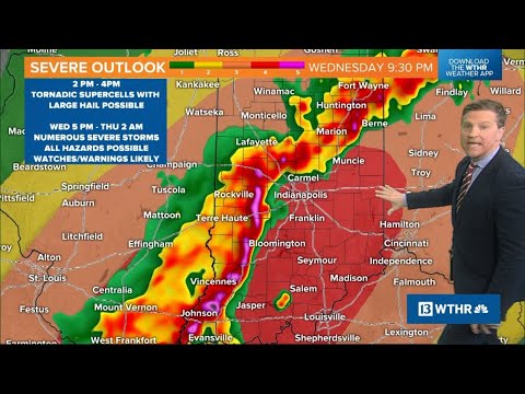
Weather Impact Alert | Afternoon severe weather outlook for central Indiana | April 2, 2025
Weather Impact Alert | Afternoon severe weather outlook for central Indiana | April 2, 2025
00:09:19 - Youtube video: DmEcVGOZa9Q

Weather Impact Alert | Tornado Watch issued for most of central Indiana | June 18, 2025
Weather Impact Alert | Tornado Watch issued for most of central Indiana | June 18, 2025
04:18:22 - Youtube video: nbD_dlex8F0
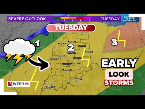
Severe weather expected Tuesday in central Indiana | Weather Impact
Severe weather expected Tuesday in central Indiana | Weather Impact
00:07:37 - Youtube video: Qi9LT666KME
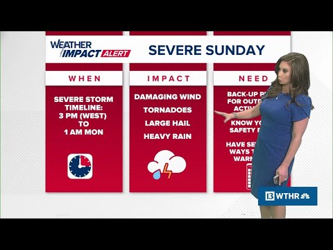
Weather Impact Alert day issued for severe storms across Indiana Sunday
Weather Impact Alert day issued for severe storms across Indiana Sunday
00:09:54 - Youtube video: HZhhdOrygPA
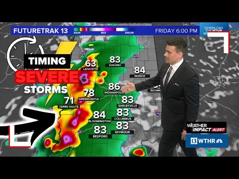
Timing when to expect severe storms for Indiana | Wind, hail and tornado alert
Timing when to expect severe storms for Indiana | Wind, hail and tornado alert
00:14:51 - Youtube video: x08yREhi0UM
Morgan County preparing for potential flooding from severe storms
Morgan County preparing for potential flooding from severe storms
00:01:23 - Youtube video: 0iniUzzLenM

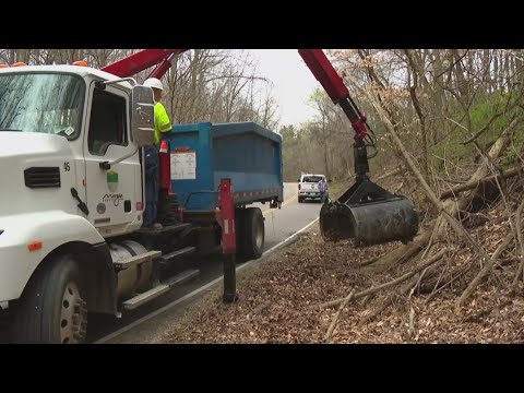
Extensive damage, power outages after apparent tornadoes in Indiana | 13Sunrise team coverage
Extensive damage, power outages after apparent tornadoes in Indiana | 13Sunrise team coverage
00:11:10 - Youtube video: jISZ-joBnic