Loading...
Related Footage
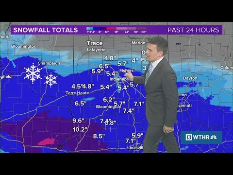
10 p.m. update on winter snow storm in Indiana | Weather Impact Alert
10 p.m. update on winter snow storm in Indiana | Weather Impact Alert
00:11:37 - Youtube video: OrZdavFnZSY
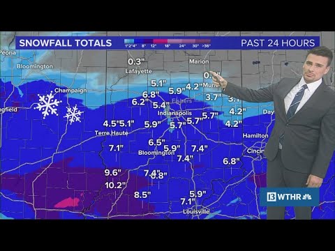
9 p.m. update on winter snow storm in Indiana | Weather Impact Alert
9 p.m. update on winter snow storm in Indiana | Weather Impact Alert
00:11:03 - Youtube video: JTmvtDia70M
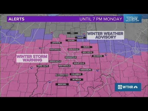
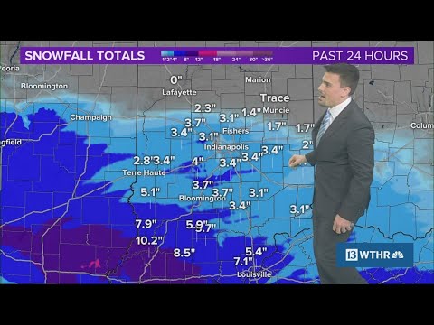
7 p.m. update on winter snow storm in Indiana | Weather Impact Alert
7 p.m. update on winter snow storm in Indiana | Weather Impact Alert
00:14:01 - Youtube video: 7hfDg9GkXrY
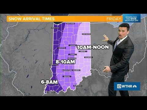
Looking ahead to Friday's snow in central Indiana | Weather Impact Alert
Looking ahead to Friday's snow in central Indiana | Weather Impact Alert
00:13:40 - Youtube video: c2ooKb3Yi7E
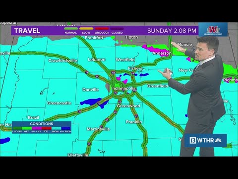
2 p.m. update on winter snow storm in Indiana | Weather Impact Alert
2 p.m. update on winter snow storm in Indiana | Weather Impact Alert
00:17:06 - Youtube video: h2sKBgWMHgY
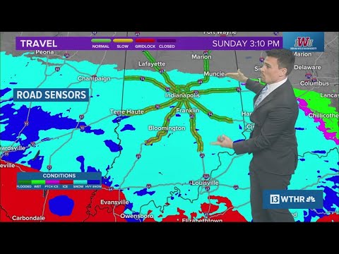
5 p.m. update on winter snow storm in Indiana | Weather Impact Alert
5 p.m. update on winter snow storm in Indiana | Weather Impact Alert
00:14:48 - Youtube video: rqIbRZu-Jes
4 p.m. update on winter snow storm in Indiana | Weather Impact Alert
4 p.m. update on winter snow storm in Indiana | Weather Impact Alert
00:19:07 - Youtube video: WY7YVwtxTrU