Loading...
Related Footage

Tracking Tropical Storm Humberto, Invest 94-L
Tracking Tropical Storm Humberto, Invest 94-L
00:23:02 - Youtube video: eFpJaOE4Fv4
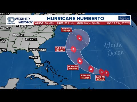
Weather Impact Live: Tracking Hurricane Humberto, Invest 94-L in the tropics
Weather Impact Live: Tracking Hurricane Humberto, Invest 94-L in the tropics
00:23:08 - Youtube video: W-5MTEy7SEk
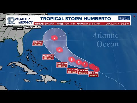
Weather Impact Live: Tracking Tropical Storm Humberto, Invest 94-L
Weather Impact Live: Tracking Tropical Storm Humberto, Invest 94-L
00:00:00 - Youtube video: uIWaZUTt9MU