Loading...
Related Footage
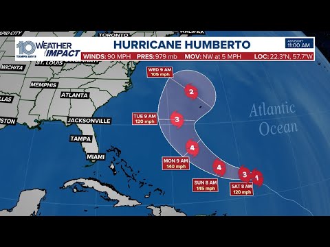
Weather Impact Live: Tracking Hurricane Humberto, Invest 94-L in the tropics
Weather Impact Live: Tracking Hurricane Humberto, Invest 94-L in the tropics
00:23:08 - Youtube video: W-5MTEy7SEk
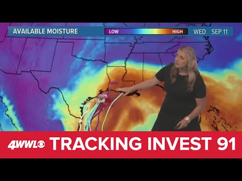
Saturday 10 PM Tropical Update: Invest 91-L could bring impacts to Louisiana midweek
Saturday 10 PM Tropical Update: Invest 91-L could bring impacts to Louisiana midweek
00:02:06 - Youtube video: CA8ZMPWsjRo
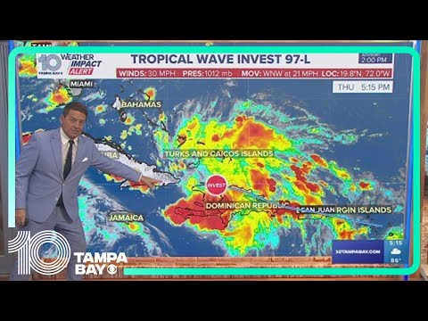
Tracking the tropics: Disturbance in the Atlantic could bring heavy rainfall to Florida
Tracking the tropics: Disturbance in the Atlantic could bring heavy rainfall to Florida
00:04:13 - Youtube video: Etrzq7pEKds
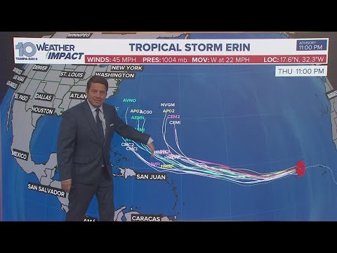
Tracking the Tropics: Tropical Storm Erin expected to strengthen into major hurricane, NHC says
Tracking the Tropics: Tropical Storm Erin expected to strengthen into major hurricane, NHC says
00:02:23 - Youtube video: -brVKs_3NrI
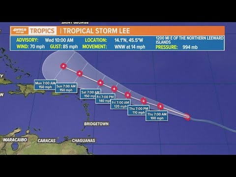
Wednesday noon tropical update: Lee expected to become hurricane by weekend
Wednesday noon tropical update: Lee expected to become hurricane by weekend
00:01:35 - Youtube video: lWbtvRWq1Rc
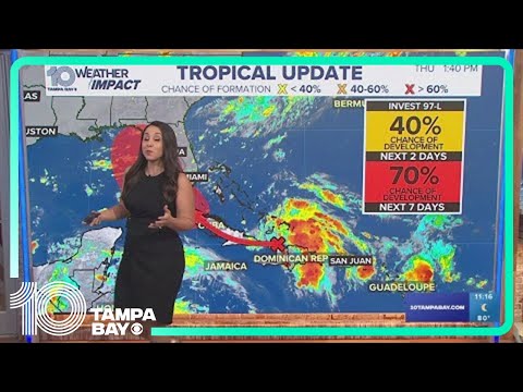
Tracking the Tropics: Tropical wave has high chance of developing into depression | Friday, 6 a.m.
Tracking the Tropics: Tropical wave has high chance of developing into depression | Friday, 6 a.m.
00:02:09 - Youtube video: KWauifl7fVg
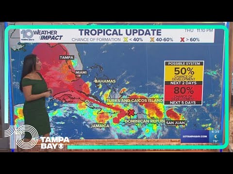
Tracking the Tropics: Heavy rainfall coming to Florida ahead of possible tropical system
Tracking the Tropics: Heavy rainfall coming to Florida ahead of possible tropical system
00:03:20 - Youtube video: KiCJpxqoQZk
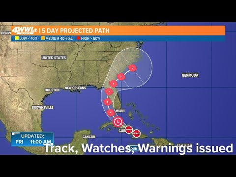
Friday 10 am Tropical Update: Track, watches and warnings issued for Florida
Friday 10 am Tropical Update: Track, watches and warnings issued for Florida
00:07:25 - Youtube video: v2F0SbDCG84